“take the T-bane out to the local trail system (which is very well marked & has ‘sports cabins’ along the way). Actually did a great run a few years ago from Holmenkollen to Songsvann – ski jump museum to start & a jump in the lake to finish if you’re feeling brave!”
-Kari V.
This was great advice and just what I wanted to hear when I put a call out to Facebook last for recommendations trail runs accessible by public transport from Oslo.
Planning
So I used the app, View Ranger, to plot a route from Holmenkollen to Songsvann, using Google Maps when needed to actually locate these places on ViewRanger’s map. I wanted to do 30KM plus but there were so many trails visible of ViewRanger, it is possible to do any mileage in this vast trail system.
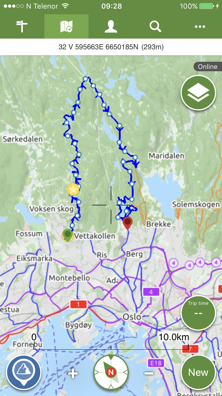 I used Googlemaps to plot a route from my hotel to the start of my run, Holmenkollen. My route consisted of the number 31 bus followed by the No.1 T-bane.
Ticket
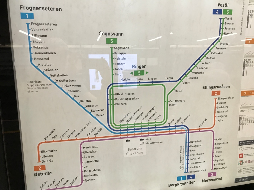
The best option for ticketing was to get an app called Ruterbillet which allowed me to purchase a 24hour Zone 1 pass, Zone 1 covers Oslo and surrounding neighborhoods, including the T-bane train so I was able to use the 24 hour pass to get from my hotel to the T-Bane station at Stortinget and on the T-bane Number 1 headting towards Frognerseteren, up to Holmenkollen. It would also get me back to my hotel from Songsvann (T-Bane number 5). Once you have the pass on your phone you don’t need to scan it or show it to anyone unless an inspector gets on.
Route
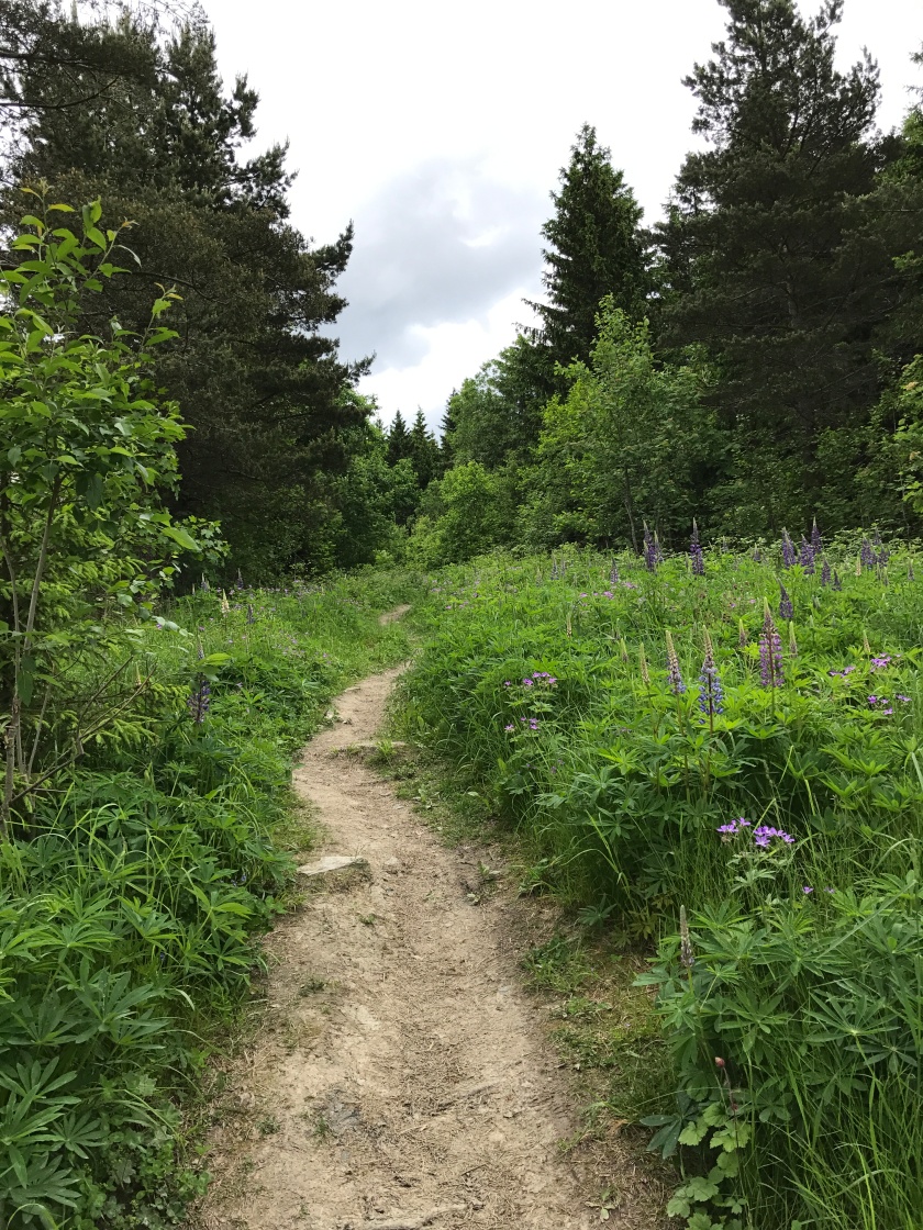
The route started off on road then, after the Holmenkollen ski jump went into a nice dry singletrack trail. Before I knew it I was on mountain bike trails, thankfully I didn’t meet any bikes but I was hyper aware of
a. Perhaps, as a runner, I was not permitted on these trails?
b. I might get hit/cause a biker to have an accident trying to avoid me
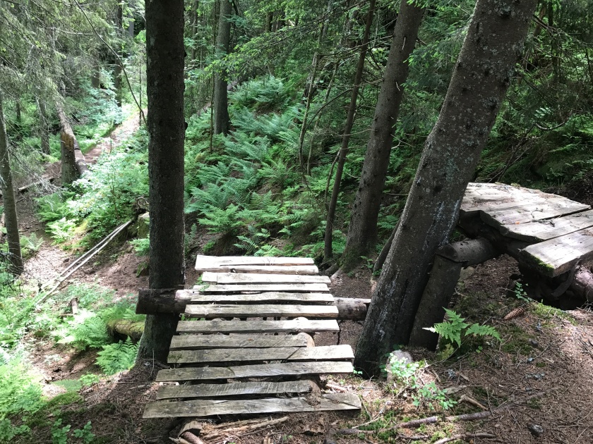
After a couple of KM I was off mountain bike trails and did not end up back on them again. The rest of the route was approx;
80% Dry singletrack
10% Fire-service road
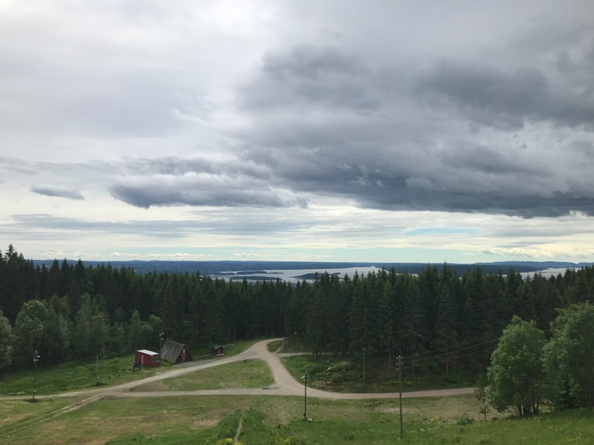
8% Marshy-grass

2% Slick rock
Sorry no photo, but think running on bare rock.
Insects
Insects got worse in the second half, in fact avoiding the mosquitoes kept me running! I didn’t notice insects in the first half of the run, it was mid June and about 20oC(approx 70F).
Amenities
This might seem like a weird category for a trail run but there were huts on this run selling drinks and snacks! All huts I came across were on the ViewRanger map, many were closed. I stopped at a hut at the most northerly part of my route, I got a cola, used their power to charge my phone (ViewRanger is hard on phone battery) and filled my water bladder.
There were many lakes on the route and a river near the end should you want to top up your water more frequently.
Enjoyment
This route was super enjoyable with varied terrain and a comfortable level of challenge. I have highly impressed with Oslo as a city with an extensive trail network accessible by public transport. As I mentioned at the start you could run loops taking in 100’s of KM or 5KM, it’s a trail running heaven up there 🙂

Hey Sara,
Congrats on the blog – looks really good and a good read. Found all info at the correct level of interesting balanced with needed facts. Really liked the info that you provided about the bus/rail ticket really handy information for anyone going to Oslo.
Good luck with Work Trip Running.
Maggie x
PS congrats on the great run at the weekend in Switzerland.
LikeLike
Thanks Maggie! I’m working on the second post and it is currently a bit wordy, hopefully I can keep striving for that interesting-facts balance.
LikeLike